


Lena Voting District, Leake County, Mississippi
About
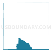
Outline

Summary
| Unique Area Identifier | 606023 |
| Name | Lena Voting District |
| County | Leake County |
| State | Mississippi |
| Area (square miles) | 30.30 |
| Land Area (square miles) | 30.26 |
| Water Area (square miles) | 0.05 |
| % of Land Area | 99.84 |
| % of Water Area | 0.16 |
| Latitude of the Internal Point | 32.60265850 |
| Longtitude of the Internal Point | -89.54655120 |
Maps


Graphs
Select a template below for downloading or customizing gragh for Lena Voting District, Leake County, Mississippi


Neighbors
Neighoring Voting District (by Name) Neighboring Voting District on the Map
- Contrell Voting District, Scott County, MS
- Good Hope Voting District, Leake County, MS
- Harperville Voting District, Scott County, MS
- South Carthage Voting District, Leake County, MS
- Walnut Grove Voting District, Leake County, MS
Top 10 Neighboring County Subdivision (by Population) Neighboring County Subdivision on the Map
- District 5, Leake County, MS (5,782)
- District 1, Scott County, MS (5,455)
- District 4, Scott County, MS (5,421)
- District 4, Leake County, MS (4,830)
Top 10 Neighboring Place (by Population) Neighboring Place on the Map
Top 10 Neighboring Unified School District (by Population) Neighboring Unified School District on the Map
Top 10 Neighboring State Legislative District Lower Chamber (by Population) Neighboring State Legislative District Lower Chamber on the Map
Top 10 Neighboring State Legislative District Upper Chamber (by Population) Neighboring State Legislative District Upper Chamber on the Map
- State Senate District 18, MS (60,602)
- State Senate District 31, MS (57,968)
- State Senate District 34, MS (55,501)